GPS Accuracy
Testing to date shows that having a setting of 10 metres as the calculated distance to a control site works effectively as the determination that a runner has visited the correct location.
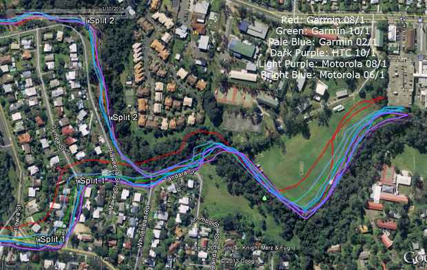
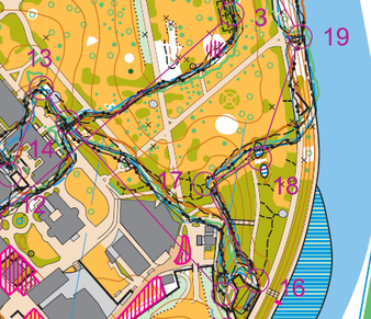
This image shows a "course" used to validate/refine the 10m proximity setting (distance to controls to register a "hit"). I run the same course – and with control placement I currently have and a 10m proximity setting – I haven’t missed a control hit yet (I run with my GPS watch and one or two Android phones). This shows my “turn-around” point:
This image shows a "course" used to validate/refine the 10m proximity setting (distance to controls to register a "hit"). I run the same course – and with control placement I currently have and a 10m proximity setting – I haven’t missed a control hit yet (I run with my GPS watch and one or two Android phones). This shows my “turn-around” point:
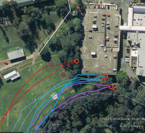
The most inaccurate tracks are the ones from the Garmin 610.
This image shows the "turn-around" point - ignoring tracks from the Garmin. It shows a circle with a radius of 15 metres.
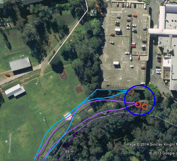
This image shows the Android-only tracks . The yellow line is approximately 15 metres long.
Other Sample Events
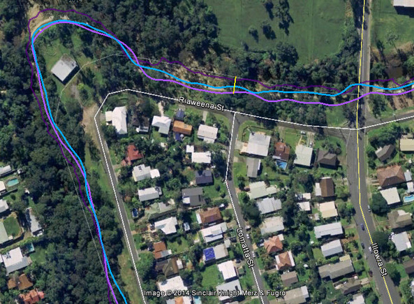
A couple of other sample events are discussed here to show the effectiveness of using GPS tracking. This image shows an extract of a file showing multiple GPS tracks:
- Two Garmin GPS watch tracks are shown: Black and Black Dots.
- Other tracks are: HTC Black double dots and Green;
- Motorola: Blue and Blue dotted; Samsung: Black dotted.
These tracks were created as follows:
- I ran the course carrying 3 Androids running the MyOMaps App (15 metre tolerance) and my Garmin 610
- I ran the course twice so that gave me 8 tracks
- See the attached (Note the text in Red lists the devices and the colour of their tracks).
On both runs I succeeded in getting a hit on all control sites with the main device I was monitoring – so I got a valid splits file in each case. However, controls 5, 6 and 8 which are down between high-rise buildings caused some trouble to get a hit. I’d be avoiding this type of control in GPS Orienteering.
